πŸ“ž +40 357 804 071 βœ‰οΈ office@dromcons.ro πŸ“ 44 Vasile Milea Street, Arad
Mon-Fri 9:00–17:00

ERT Geophysical Surveys & Seismic Investigations

Get a clear picture of the subsurface without excavation: stratification, depth to bedrock, wet zones or groundwater, voids and potential instabilities – for safer decisions in design and execution.

Useful Ground Information Before Construction Begins

In practice, many delays and additional costs are caused by limited knowledge of actual subsurface conditions. Using geophysical methods, we can quickly obtain relevant data to reduce technical risk and plan the project correctly.

At Dromcons, we use two different types of investigations: ERT (electrical imaging) and seismic methods (wave propagation through the ground). We choose them according to the project objective; in some cases we correlate them, but this is not mandatory.

ERT – Electrical Resistivity Tomography

What ERT Is and What It Provides

ERT (Electrical Resistivity Tomography) is a non-invasive method that measures the electrical response of the ground and converts it into interpretable 2D or 3D sections. In practice, you get a β€œmap” of subsurface variations along the measured profile.

What You Can Identify with ERT

  • Ground stratification and lateral variations such as heterogeneities
  • Depth to a more competent layer or bedrock
  • Wet zones and potential groundwater, depending on the context
  • Voids or cavities and fill areas
  • Weak zones or potentially unstable areas

What We Deliver

  • survey plan including profiles, electrode spacing and array configuration
  • field measurements with quality control
  • processing, interpretation and correlation with field observations
  • technical report with conclusions and recommendations
ERT field survey – cables and equipment

Seismic Investigations – Subsurface Characterisation Through Wave Propagation

What Seismic Investigation Means in Geotechnical Projects

Seismic investigations use wave propagation through the ground to obtain information about subsurface structure and, depending on the method, the properties of the materials. They are especially useful when you need correlation between methods or parameters for geotechnical and seismic assessments.

Methods Depending on the Project

  • Seismic refraction – estimating the depth and geometry of the competent layer or bedrock
  • MASW / Vs30 – characterising shear wave velocity, useful for seismic assessments
  • HVSR – identifying the dominant ground frequency for local microzonation
  • Seismic tomography – detailed local imaging of subsurface variations where required

What We Deliver

  • selection of the appropriate method based on objective, site and constraints
  • field measurements with geometry adapted to the project
  • processing, interpretation and presentation of results
  • technical report with conclusions relevant to the project
Seismic field investigations – equipment and cables

Note: ERT and seismic investigations are different methods. We use them depending on the project objective; in some cases they can be correlated for a more robust interpretation, but they do not have to be used together.

Equipment Used

For acquisition and control, the equipment is connected to a laptop or PC. Below are the main instruments and the role of each in the investigations.

POLARES32 – ERT system

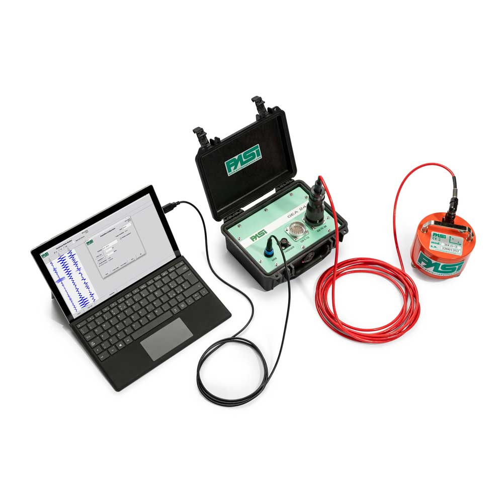
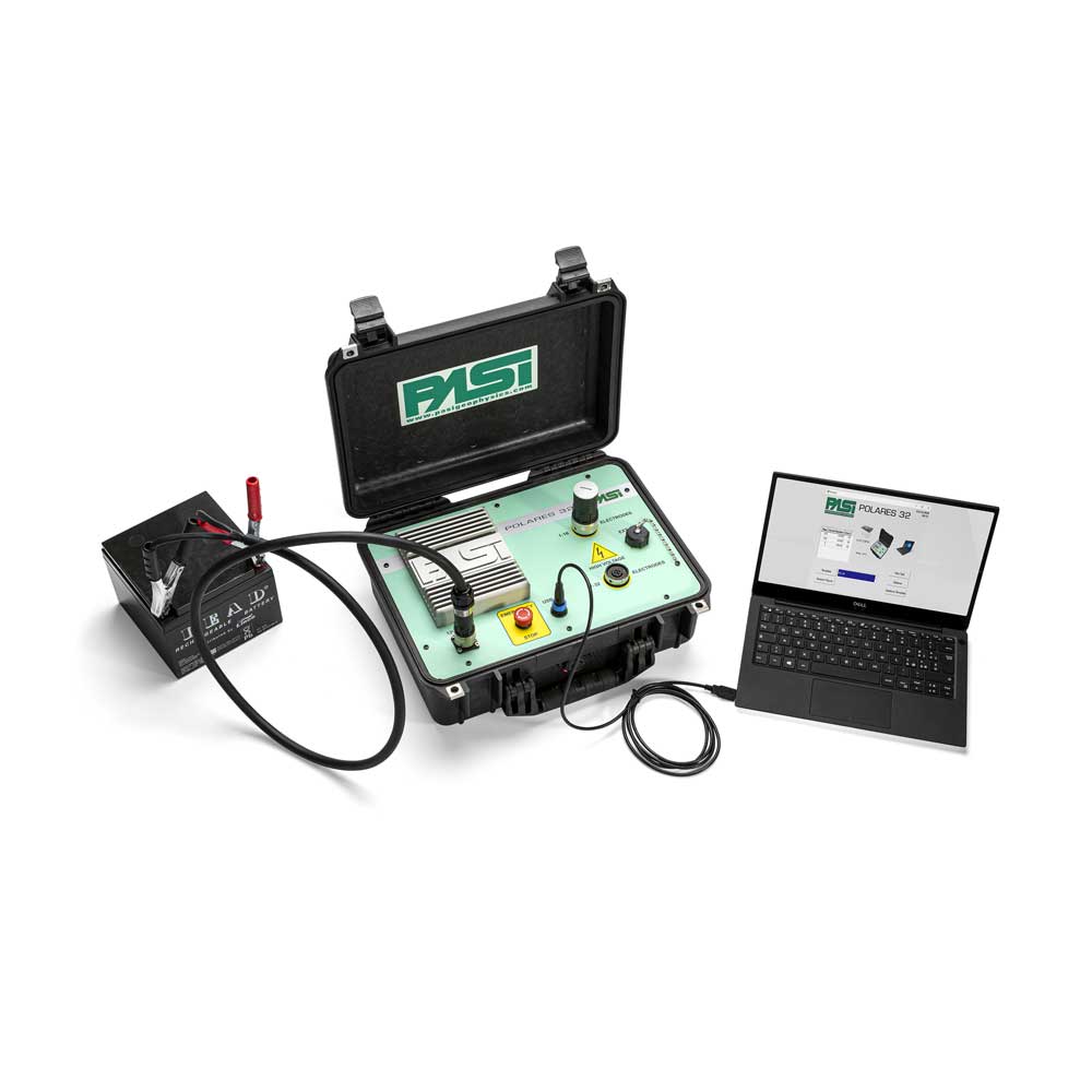
POLARES32 – ERT System

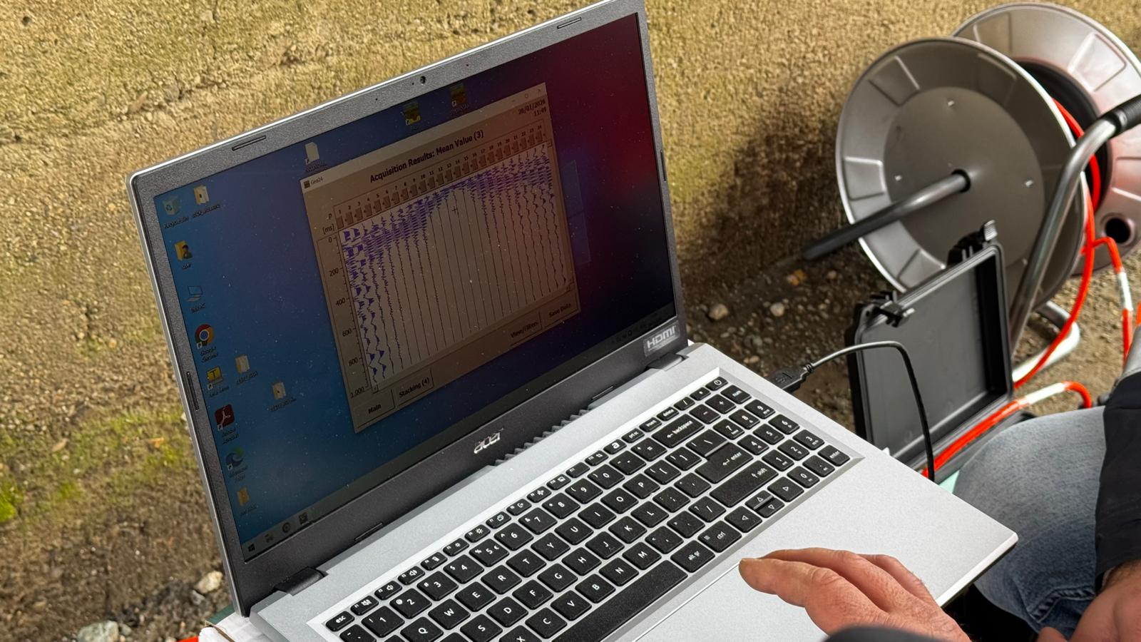
POLARES32 is a compact system dedicated to ERT measurements, designed for efficient field acquisition. It allows monitoring of the main survey parameters and real-time quality control, ensuring stable results and reliable interpretations.

  • common configurations such as Wenner, Schlumberger and Dipole–Dipole, plus custom sequences
  • automatic switching on multi-electrode arrays for fast measurements
  • intuitive acquisition software with direct project-based data saving

What we provide with POLARES32: ERT measurements, processing and interpretation in 2D or 3D, technical reporting and recommendations adapted to the objective, such as groundwater, voids, stratification or weak zones.

GEA24 – 24-channel seismograph

GEA24 – 24-Channel Seismograph

GEA24 is a compact 24-channel seismograph used for live seismic data acquisition in the field. It is suitable for applications such as refraction, MASW/Vs30 and other project-adapted survey configurations.

  • high-resolution 24-bit acquisition with USB connection to laptop or PC
  • low power consumption with direct PC supply, without bulky external batteries
  • field flexibility through compatibility with geophones of different frequencies

What we provide with GEA24: seismic measurements, processing and interpretation according to the selected method, technical reporting and conclusions for the project, such as Vs30, profiles, depth to bedrock and stratification.

Project Stages

  1. Initial discussion – we establish what you need to find out and what decision should be supported by the data
  2. Method selection – ERT, seismic or method correlation, depending on the project objective
  3. Survey plan – profiles, configurations, density and field access
  4. Field acquisition – measurements with quality control
  5. Processing and interpretation – sections, profiles and project-relevant conclusions
  6. Technical report – results, observations and recommendations for the next steps

Frequently Asked Questions

How long does a field investigation take?

It depends on the site, the length of the survey lines and the selected method. After a short discussion and site location review, we can estimate the duration and logistics.

Does ERT replace geotechnical boreholes?

In most cases, ERT complements classical investigations. It provides an overview and helps optimise the position and number of boreholes, but the final interpretation should always be correlated with the project objective.

When do you recommend seismic investigations?

When dynamic parameters are required, such as Vs30, or when method correlation is useful for a more robust interpretation of the subsurface.

Do you have a site that needs assessment?

Send us the location and objective – we will recommend the right method

We will reply with a clear recommendation, whether ERT, seismic or a combined approach, together with the steps, estimated time and the information needed for a quote.

Contact Us